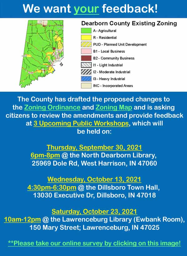
Dearborn County Citizens ALERT- PROPOSED CHANGES TO THE COUNTY ZONING MAP ONLINE AT THE LINK BELOW: ( IT SHOWS THE CURRENT MAP AND ALSO THE 2 PROPOSED MAPS.)
CHECK YOUR AREA OUT AND PROVIDE FEEDBACK VIA SURVEY, MEETING ATTENDANCE FEEDBACK, OR CALL PLANNING AND ZONING AT 537-8821 FOR FURTHER INFORMATION.
IF YOU HAVE AGRICULTURALLY USED LAND YOU NEED TO CHECK THESE MAPS AND THE TEXT OF THE ORDINANCE CAREFULLY.
https://www.dearborncounty.org/egov/documents/1624563870_39593.pdf
Christine Brauer Mueller
Lawrenceburg Township
Background
Both recent (2019) and previous (2004) housing studies in Dearborn County have identified a demand for more housing options. Since the original zoning ordinance and map were created in 1965, there has always been one Agricultural Zoning District and one Residential Zoning District. As the county ordinances have not been changed to account for certain types of residential uses and structures, these types of development have been limited—in terms of the types of housing that can be built without variances, conditional uses, and / or rezones, and also the options available in the (unincorporated areas of the) county for lots for residential uses and related uses, improvements, and amenities.
Last year, on October 21, 2020, the Dearborn County Plan Commission and staff, along with a consultant team, held 2 public workshops to review and discuss draft changes to the text of the Dearborn County Zoning Ordinance—specifically with respect to Agricultural and Residential Zoning Districts, including: adding new zoning districts, potential changes to permitted and conditional uses within each zoning district, new or expanded or amended definitions of uses and limitations related thereto, and changes to dimensional standards such as setbacks, minimum lot sizes, lot widths, etc. At these 2 previous public workshops and for several weeks before and afterwards, the Dearborn County Plan Commission and staff also conducted an online survey to get the community’s feedback on the draft texts. After seven (7) months of careful consideration and analysis of all of the feedback received from both the workshops and survey, the Zoning Technical Advisory Group, County staff, as well as the Plan Commission and the consultant team made several changes to the draft texts to reflect and address the community’s expressed preferences and concerns—and to address additional internal questions and issues that surfaced.
As these draft texts to change the Zoning Ordinance were being refined and updated further, work was initiated by the Plan Commission, staff, and consultant team to create draft zoning maps to convert the existing zoning map and its 1 Agricultural and 1 Residential Zoning District into the 2 Agricultural and 3 Residential Zoning Districts that are currently being proposed (in the updated, draft Zoning Ordinance text). The Plan Commission staff and consultant team produced a series of maps that took into consideration: the current zoning map, the existing land uses identified for all properties in Dearborn County for the Comprehensive Plan Update (which is also in the process of being updated), the soils and topography of the County, the location of floodplain and flood-prone areas, the availability of water and sewer services in the County (now and in near-term projections), environmental constraints, future land use mapping from the current Dearborn County Comprehensive Plan, board and staff member first-hand knowledge regarding certain properties, and consideration to prior zoning and land use maps created from the 1960’s to the present. For the past 4-5 months, the “working” draft maps have been changed several times and the number of map alternatives have been narrowed down to 2 maps—both of which are aimed to be “conversion” maps, focused on changing the previous (2) Agricultural and Residential zoned areas to the new (5, total) classifications—and not affecting any changes involving other zoning districts (for commercial / business or industrial uses).
Purpose
The purpose of the 2 workshops on July 20, 2021 is to identify if there are any questions, issues, concerns and / or recommendations regarding the updated, draft zoning ordinance text and the community’s input regarding the 2 draft alternative zoning maps—specifically with respect to the new Agricultural and Residential Zoning Districts. As noted last year, the ultimate aim of these efforts is intended to be an updated zoning ordinance and map that accurately reflects the value of agricultural lands and uses of the county, the housing needs and character of the community, and to allow for more up-to-date tools in the land use and development toolbox.”
Thank you for your time and attention.
Respectfully,
Mark McCormack
Director of Planning & Zoning, Dearborn County
165 Mary St., Lawrenceburg, IN 47025
Ph: 812-537-8821 I Fax: 812-532-2029
Email: mmccormack@dearborncounty.in.gov
Website: www.dearborncounty.org/planning